
Need to know when the stars and horizon are appropriately bright enough for your sextant? Our nautical twilight calculator shows you the window when both are visible – that narrow period that works best for visual celestial navigation at sea.
Features of the nautical twilight calculator
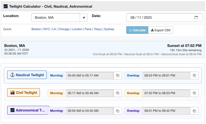
Welcome aboard, sailor – here's your nautical twilight toolkit:
- Morning and evening windows: Nautical dawn to civil dawn, civil dusk to nautical dusk
- Duration tracking: See how long you have for celestial observations
- Location search: Find ports, harbors, landlocked cities, or even just enter latitude and longitude coordinates directly
- Copy buttons: Quick transfer nautical twilight times to your tools (or logs)
- CSV export: Download the twilight math for your voyage planning spreadsheets
- Live countdown: Real-time tracking to next nautical twilight
We use SunCalc.js for calculations, and cities.json for lat/lng lookup based on city inputs.
Compare twilight types
Nautical twilight sits between civil and astronomical twilight:
- Civil Twilight Calculator (−6° to 0°): General outdoor activities
- Nautical Twilight (−12° to −6°): Current tool – horizon visible for navigation
- Astronomical Twilight Calculator (−18° to −12°): Dark enough for deep-sky observation
- All Twilight Types: Compare all three on one page
All three twilight types appear on this page, but nautical twilight takes top billing here.
What is nautical twilight?
Nautical twilight occurs when the sun's center is between 6° and 12° below the horizon. This is the "sweet spot" when the horizon is still visible for navigation, but stars are bright enough to use with a sextant. It happens twice daily: nautical dawn (before civil dawn) and nautical dusk (after civil dusk).
The term nautical isn't merely maritime marketing. This twilight phase is genuinely important for navigation at sea, where GPS might fail but the stars never do. To this day, sextants are reliable backups for when electronic navigation fails (or, in modern times, when it's jammed).
From kamals to sextants: Navigating history
Arab navigators used the kamal from the sixth century on – a simple board on a string they'd grip with their teeth to measure star heights. Portuguese explorers in the 15th century upgraded to quadrants, but these were tough to use on rolling ships – though certainly good enough to power the Age of Discovery.
The game-changer came in the 1730s when Thomas Godfrey of Philadelphia and John Hadley of England independently invented the sextant (though Isaac Newton and Robert Hooke were both said to have sketched similar ideas earlier).
The key insight? Per Wikipedia, "Star and planet sights are normally taken during nautical twilight at dawn or dusk, while both the heavenly bodies and the sea horizon are visible." (And there it is.)
The sextant's design has remained largely unchanged for 250 years. And today, nautical twilight remains the optimal time for celestial navigation – but it's an optical phenomenon. It's a window when you can see both where you are (the horizon) and where you're going (the stars).
Military operations at sea
The U.S. military takes nautical twilight seriously enough to acronym it: BMNT (Begin Morning Nautical Twilight - sometimes 'first light') and EENT (End of Evening Nautical Twilight).
Understanding nautical twilight duration
Like all twilights, nautical twilight duration depends on latitude and season:
- Equator: ~23-26 minutes year-round
- Mid-latitudes (40°): 30-40 minutes, extending in summer
- High latitudes (60°): 50-120+ minutes, sometimes all night in summer
- Arctic Circle: Can experience weeks without nautical darkness in summer
For mariners, longer nautical twilight at high latitudes means more time for star sights – helpful when navigating tricky northern passages. Want to see these twilight zones mapped globally? Check our day/night world map with live twilight terminators.
Related tools
- Sunrise Sunset Calculator - Full day planning for mariners
- Blue Hour Calculator - Occurs during nautical twilight
- Sun Angle Calculator - Precise solar positions at sea
- Moon Phase Calculator - Lunar navigation planning
- Solar Tracker Map - Global sun position tracking
- World Clock - Port time zone conversions
- Hours Between Times - Calculate watch schedules
- Time Zone Converter - Coordinate with shore-based operations
- Civil Twilight Calculator - When general visibility ends
If you're someone who likes knowing when the horizon disappears, nautical twilight marks that transition. And that's something you share with generations of sailors – after all, the horizon hasn't changed in thousands of years.
